Our approach
Survey Intelligence is specialised in modelling and monitoring of the surface and subsurface. What makes us different from other companies is that we provide the missing link between satellite data and geology.
The missing link
There is a lot of information available about the earth's surface. The trick is to find these information sources, combine them and use them to complement each other.
Finding these sources may sound a bit obscure. It's not like we're opening up a little drawer bulking with secret information. Usually it's information you're already sitting on. We enable you to retrieve information from large data sets available to you, even though you may not be aware of the fact that these sources are within your reach.
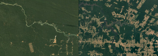
Data sources
We use every source available to build our model: seismic, gravimetric, GPS, and yes: satellite data and optical images.
Working with satellite data has a lot of advantages:
- Cost effective (compared to conventional methods)
- Quasi real-time updates (weekly updates)
- Large scale geographical coverage
- Access to historical data (possibility to see long time trends and to spot sudden changes)
- High measurement density (millions of measure points)
Handling big data
The data we use is complex and rich in information. But most of it remains hidden to the non-expert eye. Revealing hidden information requires special skills and a certain mind set: to be open for questioning conventions, pay attention to details and challenge the status-quo. Luckily, we have a multi-disciplinary team that excels in finding signal in the noise. This is how we work:
- Data conditioning (correct for errors and anomalies, reduce uncertainties)
- Reveal trends (analyse and filter data to reveal hidden trends)
- Stress analysis & interpretation (not all movement generates stress; identify impact of stress, time of occurrence and location)
- Prediction (model stress and impact evolution)
- Recommendations
VIU
We think it's essential that out of the noise of all that data we can paint a picture that you can easily understand. This is were VIU comes in. VIU (Visualise Identify Understand) is the core of our data analysis approach:
- We visualise the data to make it easier to analyse the data
- We use our geo-statistical models to identify trends
- We use our expertise and liaise with our customers to understand the triggers of these trends and to be able to make predictions
AI at our service
Of course, we don't do it all by ourselves. Big data requires big intelligence. We therefore make grateful use of developments in the field of artificial intellligence. Thanks to AI and statistical learning, we are able to discriminate long-term and short-term drift as well as to characterise signal randomness. This allows us to understand and predict the underground evolution over time. And it allows you to make to make data-driven decisions.